EPIGRAPH
THE BEGINNING
THE HISTORY OF BAM
BAMLAG
AFTER THE WAR, BUT BEFORE BAM
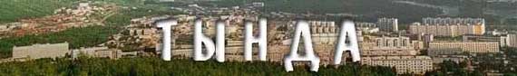
THE CITY
THE BIG CITY
THE CELEBRITIES
THE ART AND SOCIAL LIFE
THE FIRST DECADE. 1975-1985.
CHRONOLOGY OF EVENTS.
THE BREAKING POINT
SOUL RELAXATION
CATASTROPHES
WHAT'S LACKING IN THE CITY
WOULD YOU LIKE MORE DETAILS?
TOWNS AND VILLAGES OF THE AREA
EPILOG
Tynda (Biased Notes)
WOULD YOU LIKE MORE DETAILS?
Here I am going to present excerpts from the yet unpublished Tynda area geography textbook by Galina Kuznetsova.
The environment of our area has not been studied sufficiently.Not all natural resources have been discovered.This can be explained by the fact that nobody really paid attention to the research of the northern parts of the Amur Region.Most of the research was done only along the mainline.The rest of the area is poorly researched.
NATURAL RESOURCES
The most important precious metal in the area is gold.Gold deposits can be alluvial or vein-like.Mostly, there are alluvial deposits.One can find anything from gold dust to large nuggets that can weigh up to a few kilos.These deposits can be found in the basins of Urkan, Urkima, Upper Larba, Big Oldoi, Dzheltulak, Taluma, Suvel'ga and Solokit Rivers.In the vein deposits the gold can be found embedded into quartz.Such deposits have been discovered in the valleys of the Urkan and Big Oldoi Rivers.The alluvial gold is mined using floating factories-dredges.
In general, Tynda area has a great potential of supplying the country with iron, titan, nickel, gold, ceramic materials, poly-metallic ores and apatites.The area is rich with construction materials.But all the discovered deposits require further exploration.
In the western part of the area, one can find water springs.Some of those springs are mineral.In 1961 In'zhyak spring was discovered in the area of the Upper Lopcha River.It's difficult to locate the spring, but in the fall-winter time it shows itself as an ice buildup on the surface.The quality of water is close to that of "Darsunskaya," but contains less carbon dioxide.
On the left bank of Nyukzha River by the Larba settlement Maloel'gakansky spring has been discovered.The quality is close to that of "Truskavetskaya."The water from both mentioned springs can be used for treatment of various stomach illnesses as well as just for drinking.
There are plenty other mineral water springs (in the basins of Nyukzha, Chil'chi and Big Oldoi Rivers).However, all of them have not been studied sufficiently and nobody knows how large are the reserves.Because of their remote location from all the major settlements, there might be only future use of the springs.
Tynda area lies in a moderate heat belt.In June the light day lasts 16 - 16.5 hours.The sun rises above the horizon up to a 56-degree angle so that the surface receives plenty of sun heat.In December the day shortens to 7 - 8 hours.The sun rises to a 10 -12 degree angle.That's why there is a lot less sun heat in winter.
During the whole year there is little wind in the area.The wind picks up only in the spring and fall, when the cyclone activity increases.
The 24-hour air temperature amplitudes are great during the whole year and with clear skies can reach 20.Annual air temperature amplitude is 47-51.Therefore, the climate in the area is sharply continental with monsoon characteristics.
The air temperature changes as one travels from south to north.The average January air temperature in Tynda is negative 31.7 degrees Celsius.
The average air temperature in July changes from 17.1 to 18.The temperature lows to 12 as one goes higher into the mountains.The maximum temperature can go up to as high as 36 Celsius, but once in ten years there could be freezing temperatures.
Negative temperatures dominate the temperature conditions of the area.A negative 30 Celsius can be observed on the average of 70 days a year.A negative 40 is observed for about 8-10 days a year.
The above-freezing temperatures dates vary from year to year, from 21st of May to 3rd of July.The end of the above-freezing temperatures period is usually at the end of August, beginning of September.In some years it's at the beginning of August.In 1984, the first subzero (Celsius) temperatures were recorded on August 10th.The above-zero temperatures period is not the same for different parts of the Tynda area.
Vegetation period in the north of the area with temperatures above 10 degrees usually lasts for 96 days.In the south -- 104 days.The length of the no-freeze period is 70 days (Tynda meteorology station).The most precipitation occurs during summer months: the second half of July - the first half of August.Summer showers usually are accompanied by thunderstorms.
The snow cover stays for 210 days in Tynda.The first snow usually appears in the middle of September or early October.The permanent snow cover builds up only in a week or two thereafter.The snow cover gradually increases over time.The most intensive growth happens at the end of October - beginning of November.After that the cover practically remains the same.This can be explained by little precipitation in the following months as well as by snow evaporation and densification.On the average the snow cover thickness is 17 centimeters.
The cover decrease starts in the second half of March and by the end of March it deteriorates.Sometimes it even snows in May, but the snow does not stick around for more than a day or two or even few hours.
All four seasons are well defined in our area.Winter is a period of stable negative air temperatures.It begins differently in various parts of the area.
……….Average season dates
………………….…..Winter…………..Spring………...Summer…………….Fall
Tynda…………….X/14-IV/11…….IV/11-VI/16……VI/16-VIII/26…….VIII/26-X/14
The winter lasts for 180 days.The coldest month is January.The minimum temperature is negative 56 Celsius.Winter lasts without a thaw until April.The cold air contains little water vapors.The clouds almost never form.It's predominantly sunny in winter.Sometimes it’s foggy.
The winter in our area brings little snow.Blizzards can only be observed whenever a cyclone passes.The number of blizzards is insignificant - up to 4 days.
Spring usually begins in the first half of April.It comes in very quickly and in a wave-like manner: warm sunny days can be replaced with colder gloomy windy days, sometimes with snow.And this happens a few times.But every new warm period brings more sun and heat.During some days the air temperature in May can reach as high as 23-28 degrees Celsius.
Summer begins in the first half of June.The average summer length is not consistent: from 72 to 96 days.The warmer month is July when the average day temperature rises to 22, and the maximum to 35.However, occasionally one can observe sub-zero temperatures.It happened in Tynda in 1978 - negative 1 Celsius.
In July and August there are more foggy days
Whenever there is a passing cyclone, the wind's velocity picks up.The winds become strong and gusty.
As was mentioned earlier, negative winter temperatures dominate the climate in our area.The central heating season lasts 254 days.
Fog hinders driving and flying.On the average, there are 31 to 38 foggy days (the max is 64).More often, it's foggy during summer months.The fog normally stays for 6 hours, however, in some cases it could stay for as long as 10 -13 hours.
It hails very little in Tynda. on the average 1-2 times a year.The maximum times it can hail is 6 (Ust'-Nyukzha).
The principal air polluting factors in Tynda are numerous heating plants (especially in wintertime) and traffic (in summertime).During winter, fresh snow turns gray in a few days.The situation could be remedied if the plants installed better filtering systems in their smokestacks.
Many rivers run through the Tynda area.The river network is vast.There are 4,808 rivers out there.The major ones are Olekma, Nyukzha, Lower Larba, Gilyui, Urkan, Middle Larba, Upper Larba, Tynda, Big Dzheltulak, Dzhalinda, Bryanta, Unakha, Utugai and Dyoss.
The major rivers begin or end outside the area, running through the area in stretches: Olekma - 17%, Nyukzha - 79%, Gilyui - 63%.
Rivers are classified as mountainous, with a rather consistent current velocity.There are small waterfalls in the mountains and upper parts of rivers.All rivers have shallow spots and rapids.Most of the Tynda area rivers belong to the Arctic Ocean basin.The largest is Olekma.It begins in the Olekma mountain range at an altitude of 1,200 meters.Olekma length is 1,436 km (in our area it's only 246 km).The major tributary is Nyukzha.It begins in the Dzheltulak mountain range, has a length of 285 km and runs in the northwestern direction.At the point of Upper Larba running into Nyukzha, the latter sharply turns northwest and runs until joining the Olekma River.
The major Nyukzha tributaries are Upper Larba, Middle Larba, Lower Larba, Chil'chi and Lopcha.Besides Nyukzha, Olekma has other tributaries in the Tynda area like Tas-Yuryakh, Dyryan-Uryakh and Khani.
In the eastern and southern parts of our area, the rivers belong to the Pacific Ocean basin.Here runs Gilyui, which is the right tributary of Zeya that runs into Amur.
Gilyui begins in the southern parts of the Stanovoi mountain range.Its length on the territory of the Tynda area is 359 km.The major Gilyui tributaries are Tynda, Small Gilyui, Big Dzheltulak, Small Dzheltulak and Getkan.All these rivers except Gilyui run through Tynda area along their full length.
Some major tributaries of Amur begin in the southern parts of the area.On the southern foothills of Urusha range begin rivers Omutnaya and Urusha.Here the rivers a typically mountainous and narrow in their upper parts.
On the foothills of Chernyshev mountain range begins the largest (in the upper part) Amur tributary Ol'doi (Small Ol'doi begins on the foothills of Yankan).In the upper parts of these rivers the current is quite strong. Big and Small Ol'doi Rivers confluence outside of Tynda area.
Forest fires cause great losses in our area.The fire season lasts 150 days.The average number of fires on 1 million hectares is 32 a year.The fires usually burn in the low lands.